|
| Home | |
| Products | |
| Purchase | |
| Download | |
|
|
Support |
Stevens Creek Birdathon 2003
|
||||||||||||||||||
|
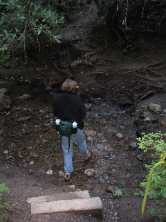
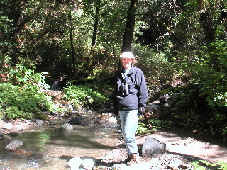
12:44 p.m. |
12:57 p.m. |
1:14 p.m. |
|
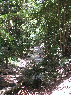
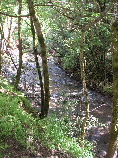
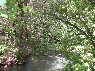
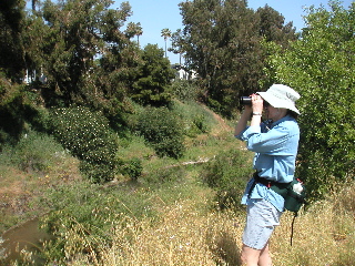
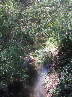
Views of the creek along Stevens Canyon Road |
||
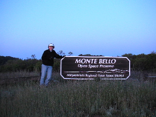
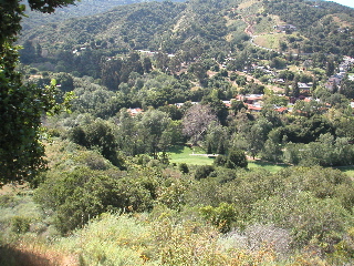
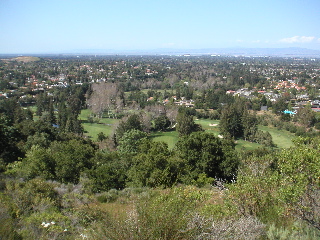
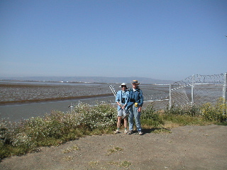
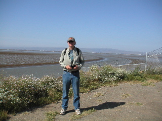
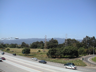
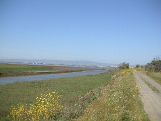
2:43 p.m.: Stevens Creek Reservoir (which Stevens Creek "flows through", as you can see quite literally when the reservoir is low). Debi sports her official Stevens Creek T-shirt (which features a picture of the creek at the Grizzly Flat crossing). Our starting point is higher and to the right of the mountains in this picture.
3:01 p.m.: Stevens Creek County Park
|
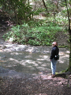
3:34 p.m. |
3:38 p.m. |
|
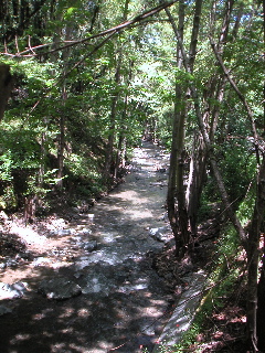
Views of Stevens Creek as it flows through Deep Cliff Golf Course,
from the ridge above Linda Vista Park. |
|
Bird Count Day 1: 69 Species
Estimated Mileage Day 1: 14.6
Species List Day 1:
Blackbird, Brewer's Blackbird, Red-winged Bluebird, Western Bunting, Lazuli Bushtit Chickadee, Chestnut-backed Cormorant, Double-crested Cowbird, Brown-headed Creeper, Brown Dipper, American Dove, Mourning Finch, House Finch, Purple Flicker, Northern Flycatcher, Ash-throated Flycatcher, Olive-sided Flycatcher, Pacific-slope Gnatcatcher, Blue-gray Goldfinch, Lesser Grosbeak, Black-headed Hawk, Cooper's Hawk, Red-shouldered Hawk, Red-tailed Hummingbird, Anna's Jay, Steller's Junco, Dark-eyed Kingfisher, Belted Kite, White-tailed Mallard Meadowlark, Western Mockingbird, Northern Oriole, Bullock's Oriole, Hooded Owl, Great Horned Phoebe, Black |
Pigeon, Band-tailed Quail, California Raven, Common Robin, American Screech-Owl, Western Scrub-Jay, Western Sparrow, House Sparrow, Song Starling, European Swallow, Barn Swallow, Cliff Swallow, Violet-green Swift, Vaux's Thrasher, California Titmouse, Oak Towhee, California Towhee, Spotted Turkey, Wild Vireo, Cassin's Vireo, Hutton's Vireo, Warbling Vulture, Turkey Warbler, Black-throated Gray Warbler, MacGillivray's Warbler, Orange-crowned Warbler, Wilson's Waxwing, Cedar Wood-Pewee, Western Woodpecker, Acorn Woodpecker, Hairy Woodpecker, Nuttall's Wren, Bewick's Wren, Winter Wrentit |
Day 2:
Route Description:
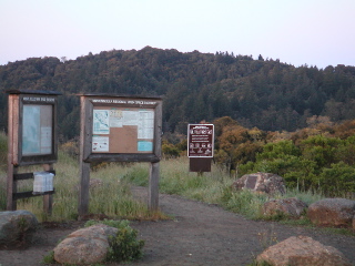
Started around 6:30 a.m. at Audubon headquarters at McClellan Ranch Nature Preserve. The route followed the Nature Trail at McClellan, then into Blackberry Farm. We then detoured out onto Byrne Avenue to bypass Blackberry Farm Golf Course, following it out to Stevens Creek Boulevard. Returning to the creek, we backtracked a bit into the Stocklmeir property, where we picked up a White-breasted Nuthatch and 6 golf balls. From Stevens Creek Boulevard to about a mile south of El Camino, Stevens Creek passes through impassable private property, so we had to follow a somewhat circuitous route: Phar Lap Drive to the railroad tracks (the spur line that ends at the quarry at the end of Stevens Creek Boulevard), then follow the railroad tracks northwest, passing over Stevens Creek. Leave the trackbed on the west side of Foothill Boulevard, then along Foothill and Homestead back to just before Stevens Creek at Fallen Leaf Dr. Fallen Leaf Dr. follows the creek until Fremont, where we turn east, passing over the creek yet again and then under 85 and left on Bernardo. Stevens Creek soon passes under 85 and joins us on the east side of 85, as we follow it closely along Bernardo, Robin, Cardinal [these are streets, not birds!], Knickerbocker, Heatherstone, and Dale until we reach El Camino. Stevens Creek passes back under 85 just before Heatherstone, so when we reach El Camino, we backtrack about a half mile along the section of the creek which is quasi-accessible (no questions, please) on the west side of 85 south of El Camino.
Following a much-needed lunch break at a conviently placed Burger King, we continue across El Camino and down Yuba Dr. until it reaches the end of the paved portion of the Stevens Creek Trail, which then follows the creek all the way to Shoreline Park. Just as we reach Shoreline, we cross over a bridge to the east side of the creek, which puts us on a levee which then goes out another mile or so to the creek mouth (then we have to backtrack a mile to the nearest parking lot to get to our car).
Birding Highlights:
Birding hotspots like McClellan Ranch Nature Preserve and Blackberry Farm didn't add many new species, since we had seen so much the day before. The railroad underpass under Foothill Boulevard afforded great views of Northern Rough-winged Swallows. Walking along city streets from Stevens Creek Boulevard to El Camino, we weren't expecting much, but there in a tree above a garage was a spectacular pair of Western Tanagers (we would see a couple more - possibly the same pair? - further downstream), and then, sitting on a light globe in front of a house, our first American Goldfinch (we would see more of those later as well). Some excellent close-up views of White-throated Swift just past the 101 underpass. Along the Stevens Creek Trail, a pair of Cedar Waxwings moved together from branch to branch, looking very much like they were a breeding pair, which would be extremely rare for Santa Clara County. Nuttall's Woodpeckers were everywhere, making them the "trash bird" of the day, following in the footsteps of yesterday's Black-headed Grosbeak.
Close to the end of the trail, a large group of Ruddy Ducks were in full breeding plumage and very attractive. Hidden amongst one group was a pair of Eared Grebes, also in full breeding plugmage, and hidden in another was a nice Western Grebe. Also, in Stevens Creek itself, a solitary Long-billed Curlew was feeding.
Nearing the Bay, a birding couple told us of the Townsend's Warbler they had just seen, but we could never see it. Later, on our way back from the trail's end, we met them again and they also told us about a Golden Eagle and a Marsh Wren they had just seen. We could actually see the eagle at a VERY long distance, but since none of us could have positively identified it without their assurance, we couldn't add it to the list. Likewise, we were pretty certain we heard the Marsh Wren, but didn't feel we could add that to the list either. Adding those two would have put us at an even 100, but then, we didn't even see a Great Blue Heron, Downy Woodpecker, Harrier, or Kestrel in two days. The extreme lack of diversity at the creek mouth, with numerous expected species among the missing, also held the count down. However, playing "what if" doesn't get us very far - we were perfectly delighted with 98, which far exceeded our original expectations.
At the very end of the day (5:00 p.m.) we reclaimed our car which was in the last parking lot before the Shoreline Park entrance (left there the previous evening). After no more than 100 yards, and still well within our 1/4 mile "target" of Stevens Creek, there perched on a low telephone wire was a Burrowing Owl! We screeched to a stop. The owl dropped down to the road maybe 10 feet from the back of our car, then hopped up on the curb, all the while giving us amazing close-up views of his handsome face. It didn't conform 100% to our "rule" (we weren't on foot at the time), but it was such a perfect end to our expedition we had to add him to the list.
Pictorial Highlights:
6:49 a.m.: McClellan Ranch Nature Preserve
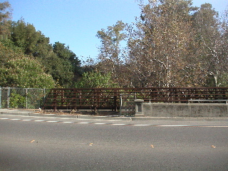
8:13 a.m.: The intersection of Stevens Creek and Stevens Creek (Boulevard)
10:07 a.m.: Fremont Ave.
11:04 a.m.: From the El Camino overpass over 85, a view of the Day 1 starting point in the mountains, as well as the "backtrack" section along the west side of 85
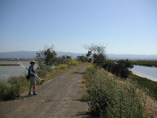
11:21 a.m.: Birding the backtrack section, at one of the few places where the creekbed is wide (not very far upstream from this point, the creekbed becomes very steep and very narrow, which it remains all the way to Stevens Creek Boulevard)
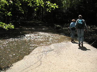
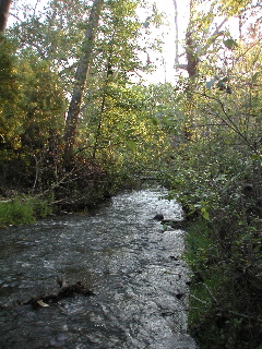
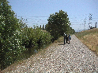
1:18 p.m.: The Stevens Creek Trail affords great views of the creek
2:28 p.m.: Other birders saw a Townsend's Warbler right here, but we weren't as lucky. Timing is everything.
4:10 p.m.: The last stretch of trail to the east of the creek as it heads out toward San Francisco Bay in the distance
|
|
|
|
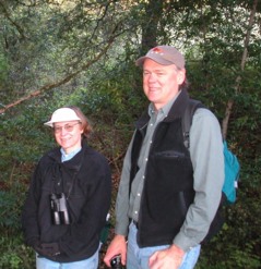
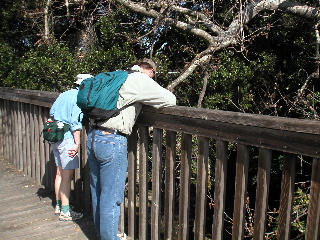
4:13 p.m.: Debi & Steve (left) and Grant (right) reach the end of the line, as Stevens Creek flows into San Francisco Bay |
|
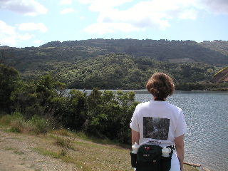
4:25 p.m.: Heading back, with one last look at the Santa Cruz Mountains where we started the adventure Saturday morning
Bird Count Day 2: 29 Species
Estimated Mileage Day 2: 11.8
Species List Day 2:
Avocet, American Coot, American Crow, American Curlew, Long-billed Dove, Rock Duck, Ruddy Egret, Great Egret, Snowy Gadwall Goldfinch, American Goose, Canada Grebe, Eared Grebe, Western Gull, California Gull, Glaucous-winged |
Killdeer Nuthatch, White-breasted Owl, Burrowing Pelican, American White Pheasant, Ring-necked Scaup, Lesser Shoveler, Northern Stilt, Black-necked Swallow, Northern Rough-winged Swift, White-throated Tanager, Western Teal, Cinnamon Tern, Forster's Yellowthroat, Common |
| Products | Buy Now | Downloads | Support | Info for Resellers | Site Map | Contact Us | About Us |
| © 1997-2010 Stevens Creek Software. All Rights Reserved |